Managing a construction site is a constant battle to stay informed. Many project managers still rely on manual site walks to track progress. They walk the grounds with a smartphone and a clipboard, taking photos and notes. This traditional method creates a “visibility gap.” The information is often outdated by the time it reaches the office.
In contrast, professional drone monitoring provides objective and measurable data. It replaces guesswork with high-resolution evidence. This guide compares traditional manual walks against aerial data to show how technology improves site speed, safety, and your bottom line.
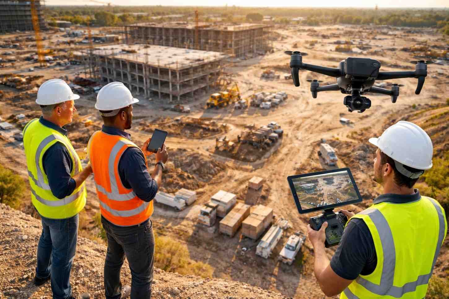
1. Saving Time on the Job Site
The most immediate cost on any project is labor. When a high-level manager spends half a day walking a site just to document progress, they are not managing the build. A manual inspection for a 15-acre site can take four to five hours. This includes the walk itself, organizing photos, and writing reports.
A professional drone flight covers that same area in about 20 minutes. What you get is not a few photos; but the visuals of entire site from a top-down perspective. For teams managing a construction site drone inspection in Colorado, this shift saves hours of manual labor every week. It allows the management team to stay in the office or focus on coordinating subcontractors.
Key Efficiency Gains:
- Rapid Capture: Drones document the whole site in minutes, not hours.
- Total Coverage: You see the entire property, not just what a person could reach on foot.
- Fast Delivery: We deliver actionable data within 24 to 72 hours.
2. Better Data for Better Decisions
Manual photos often lack context. A ground-level shot of a foundation tells you it exists, but it doesn’t tell you if it is in the right place. To get real value, you need a “Digital Twin” of the project.
We use advanced mapping to stitch hundreds of high-resolution images into one large, measurable map. This is called an orthomosaic map. It allows engineers to overlay their original blueprints directly onto the current site images.
Using drone site progress monitoring in Kansas, developers can spot mistakes before they become expensive. This level of precision is impossible with a standard camera. We at Quad-P Aerial use Hasselblad cameras on our drones to ensure every detail is sharp.
3. Improving Site Safety
Construction sites are high-risk environments. Every time a person walks through an active work zone, the risk of an accident increases. Navigating around heavy machinery, open trenches, or climbing unfinished stairs is a liability.
Drones keep people out of harm’s way. By utilizing aerial construction progress tracking in Wyoming, you can inspect roofs, cranes, and high-elevation structures from the ground. This significantly lowers the risk of a fall or injury.
At Quad-P Aerial, safety is our primary focus. Our founder, Kevin Michael Haley, is a U.S. Army veteran who brings military discipline to every flight. With over 3,000 successful flights, we make sure the job is done without adding risk to your site.
4. Resolving Disputes with a “Project Black Box”
Disputes between contractors and owners are common. When a mistake happens, it is often difficult to prove who was responsible or when the error occurred. Without a clear record, these arguments can lead to expensive legal fees and project delays.
Think of drone monitoring as a “Black Box” for your project. By flying the same path every week, we create a historical timeline. If a subcontractor claims they finished a task on a specific day, you can check the aerial record to verify it.
Contractors using progressive construction inspections by drone in Nebraska use these records to settle insurance claims and speed up bank draws. When you have visual proof of every milestone, you build trust with your investors and partners.
Ways Drone Documentation Saves Money:
- Reduced Rework: Catching a small error early prevents a $50,000 rebuild later.
- Proof of Work: Settle “he-said, she-said” arguments with dated, high-resolution evidence.
- Remote Management: Stakeholders can “visit” the site from any location, saving on travel costs.
5. Reliable Reporting Across Your Entire Portfolio
Many developers manage projects in multiple states at once. Maintaining consistent reporting quality is difficult when you rely on different people to take manual photos at each location.
Our service provides a standardized format for every project. Whether you need a construction site drone inspection in Colorado or drone site progress monitoring in Kansas, the reports look and feel the same. This consistency makes it easy for executives to review multiple projects quickly.
We offer aerial construction progress tracking in Wyoming and progressive construction inspections by drone in Nebraska with the same 72-hour turnaround. Every report is formatted for stakeholders and project managers to use immediately in their meetings.
Choose Accuracy Over Tradition
Manual site walks are a legacy method that leaves too much to chance. They are slow, carry safety risks, and provide incomplete data. Drone monitoring offers a modern solution that saves time, protects workers, and provides an undeniable record of progress. When you look at the ROI, the choice is clear. A drone service often pays for itself by catching just one major error before it requires rework.
Work with a Professional
At Quad-P Aerial Solutions, we provide the data you need to stay on schedule. Every flight is handled by a professional with thousands of hours of experience.
Ready to see your site from a new perspective? Contact Quad-P Aerial today and discover how our drone monitoring service can protect your project.